Information on Wasta, Pennington County
The City of Wasta is located in the state of South Dakota, in Pennington County. Its area, population and other key information are listed below. |
Wasta City HALL, Pennington County
| Wasta City Hall's address | Wasta Wasta Municipal Building PO BOX 15 WASTA SD 57791 United States | |
|---|---|---|
| Phone number of Wasta City Hall | Not available | |
| Wasta, SD email | Not available | |
| Wasta official website | Not available | |
| Mayor of Wasta | ||
| Pennington County, South Dakota: Vital Records | Wasta vital records | |
| Birth Certificate | Order your South Dakota birth certificate online | |
Common questions about Wasta
What county is Wasta SD in?Wasta, SD is located in Pennington County |
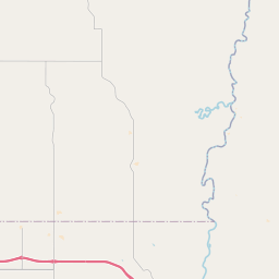
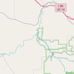
Where is Wasta, South Dakota ?Wasta is a town in Pennington County, located in western South Dakota, USA. It is situated near the Cheyenne River and lies along Interstate 90, roughly halfway between Rapid City to the west and Wall to the east. The town provides easy access to the Badlands National Park to the southeast. |
What is the cost of living in Wasta SD ? |
Wasta administrative division
| Country | United States |
|---|---|
| State | South Dakota |
| County | Pennington - other counties in South Dakota |
Wasta building department, SD
If you're planning a construction or renovation project in Wasta, SD, you'll need to obtain the necessary permits to ensure compliance with local regulations. You can request these permits through the Wasta Town Office, which is responsible for issuing and processing all permit applications. To obtain detailed information regarding the costs and processing times associated with your permit, it's advisable to contact the office directly. The staff will guide you through the necessary steps and provide any additional information you may need to proceed with your project smoothly.
| If you have inquiries related to construction permits, inspections, code enforcement, or building regulations, we recommend contacting Wasta's town hall or Pennington County authorities directly. |
Demography of Wasta
| Name of Wasta inhabitants (demonym) | Not available | |||
|---|---|---|---|---|
| Date | Current value | Classed by Region/Country | ||
| Population | 83 inhabitants | 217 / 8 328 | ||
| Population density in Wasta | 429,9 pop/sq mi (166,0 pop/km²) | |||
List of Passport Facilities in Wasta, SD
This City does not have a passport office, but we suggest the following facilities near Wasta, SD
| Name | Street | Phone number |
|---|---|---|
| USPO - BOX ELDER | 511 N ELLSWORTH RD | 6059232484 |
| RAPID CITY POST OFFICE | 500 EAST BLVD | 6053552819 |
| HAAKON COUNTY CLERK OF COURTS | 140 S. HOWARD AVE. | 6058592627 |
| JACKSON COUNTY CLERK OF COURT | 700 MAIN STREET | 6058372122 |
| USPO - STURGIS | 820 KINSHIP ROAD | 6053470100 |
| USPO - HOT SPRINGS | 146 N CHICAGO ST | 6057454117 |
| USPO - SPEARFISH | 120 YANKEE ST. | 6056423396 |
| WESTON COUNTY DISTRICT COURT | 1 WEST MAIN | 3077464778 |
| DAWES COUNTY DISTRICT COURT | 451 MAIN STREET | 3084320109 |
| SHERIDAN COUNTY DISTRICT COURT | 301 EAST 2ND STREET | 3083275654 |
| CROOK COUNTY DISTRICT COURT | 309 CLEVELAND STREET | 3072832523 |
| USPO - PIERRE | 225 SOUTH PIERRE ST. | 6052241204 |
| HUGHES COUNTY AUDITOR | 104 E CAPITOL AVE | 6057737451 |
| DEWEY COUNTY CLERK OF COURTS | 700 C STREET - COURTHOUSE | 6058653566 |
| HARDING COUNTY CLERK OF COURTS | 410 RAMSLAND STREET | 6053753351 |
Wasta administrative numbers
| Wasta City code | 4669140 |
|---|---|
| Wasta City postcode | 57791 |
Transportation modes in Wasta
| Airport | Rapid City Regional Airport 30.4 miles Ellsworth Air Force Base 33.1 miles Philip Airport 42.1 miles |
|---|
Wasta territory
| Wasta area | 0,19 sq mi (0,50 km²) |
|---|---|
| Wasta altitude | 2 320 Altitude feet |
| Geographical coordinates | Latitude: 44.0695 Longitude: -102.446 Latitude: 44° 4' 10'' North Longitude: 102° 26' 46'' West |
| Time zone | UTC -7:00 (America/Denver) Summer time : UTC -6:00 Winter time : UTC -7:00 |
| Local time | |
| Cities twinned with Wasta | Currently, the town Wasta isn’t twinned |
| Natural parks | Wasta isn't part of a natural park |
What is Wasta close to?


Leaflet | Map data © OpenStreetMap contributors
| Nearby cities include: Wall, Quinn, New Underwood and Cottonwood | ||
|---|---|---|
| New Underwood | New Underwood | |
| New Underwood |  | Wall |
 Wall | |
| Wall 11.4 miles | Quinn 16.5 miles | New Underwood 19.5 miles |
| Cottonwood 28 miles | ||
Distance between Wasta and other main cities and towns
| Los Angeles : 1101 miles | Houston : 1062 miles | Philadelphia : 1424 miles |
| Phoenix : 892 miles | San Antonio : 1034 miles | San Diego : 1110 miles |
| Dallas : 838 miles | San Jose : 1116 miles | Jacksonville : 1481 miles |
| Indianapolis : 888 miles | San Francisco : 1159 miles | Austin : 986 miles |
| Columbus : 1037 miles | Fort Worth : 828 miles closest | Charlotte : 1299 miles |
| Distances are calculated as the crow flies | ||
Leisure and activities in Wasta surrounding area
| Golf course | |
|---|---|
| Wall Community Golf Course to Wall 11.4 miles | |
