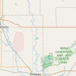
Information on Cherokee, Crawford County
The City of Cherokee is located in the state of Kansas, in Crawford County. Its area, population and other key information are listed below. |
Cherokee City HALL, Crawford County
| Cherokee City Hall's address | Cherokee Cherokee Municipal Building 210 S Vine PO Box 201 Cherokee KS 66724 United States | |
|---|---|---|
| Phone number of Cherokee City Hall | +1 620-457-8413 | |
| Cherokee, KS email | Loading... | |
| Cherokee official website | Not available | |
| Mayor of Cherokee | Dale Thompson | |
| Birth Certificate | Order your Kansas birth certificate online | |
Common questions about Cherokee
What county is Cherokee KS in?Cherokee, KS is located in Crawford County |
Where is Cherokee, Kansas ?Cherokee is a city in Crawford County, located in the southeastern part of the state of Kansas, in the United States. It lies approximately 20 miles southwest of Pittsburg and about 50 miles north of Joplin, Missouri. The city is situated near the junction of U.S. Route 69 and U.S. Route 400. |
What is the cost of living in Cherokee KS ? |
Cherokee administrative division
| Country | United States |
|---|---|
| State | Kansas |
| County | Crawford - other counties in Kansas |
Cherokee building department, KS
| If you have inquiries related to construction permits, inspections, code enforcement, or building regulations, we recommend contacting Cherokee's town hall or Crawford County authorities directly. |
Demography of Cherokee
| Name of Cherokee inhabitants (demonym) | Not available | |||
|---|---|---|---|---|
| Date | Current value | Classed by Region/Country | ||
| Population | 722 inhabitants | 234 / 7 689 | ||
| Population density in Cherokee | 1 016,3 pop/sq mi (392,4 pop/km²) | |||
List of Passport Facilities in Cherokee, KS
| Name | Street | Phone number |
|---|---|---|
| PITTSBURG POST OFFICE | 702 N LOCUST ST | 6202316000 |
| PITTSBURG STATE UNIVERSITY | 301 E LINDBURG | 6202354772 |
| CHEROKEE COUNTY REGISTER OF DEEDS | 110 W MAPLE | 6204293777 |
| COLUMBUS POST OFFICE | 223 S PENNSYLVANIA AVE | 6204292608 |
| LABETTE COUNTY REGISTER OF DEEDS | 501 MERCHANT ST | 6207954931 |
| WEBB CITY POST OFFICE | 220 W DAUGHERTY ST | 4176734346 |
| PARSONS POST OFFICE | 1700 MAIN ST | 6204213900 |
| JOPLIN MAIN POST OFFICE | 101 NORTH MAIN STREET | 4176236176 |
| JOPLIN PUBLIC LIBRARY | 1901 EAST 20TH ST | 4176237953 |
| JASPER POST OFFICE | 122 W GRAND ST | 4173942519 |
| JASPER COUNTY RECORDER OF DEEDS | 116 W 2ND ST | 4173580431 |
| LAMAR MAIN POST OFFICE | 131 WEST 11TH STREET | 4176825435 |
| MIAMI POST OFFICE | 34 A ST. NE | 9185421018 |
| FORT SCOTT POST OFFICE | 120 S NATIONAL AVE | 6202231410 |
| NEOSHO POST OFFICE | 101 E HICKORY STREET | 4174514172 |
Top 3 most popular banks in Cherokee
There are 1 bank branches in Cherokee.
Labette Bank is the most popular bank in Cherokee with 1 branch offices.
Find below all bank branches in Cherokee:
| Bank's name | Number of branch offices | Service Type |
|---|---|---|
| Labette Bank | 1 | Full Service Brick and Mortar Office |
Cherokee administrative numbers
| Cherokee City code | 2012825 |
|---|---|
| Cherokee City postcode | 66724 |
Transportation modes in Cherokee
| Airport | Atkinson Municipal Airport 8.8 miles Joplin Regional Airport 22.3 miles Miami Municipal Airport 30.4 miles |
|---|
Cherokee territory
| Cherokee area | 0,71 sq mi (1,84 km²) |
|---|---|
| Cherokee altitude | 932 Altitude feet |
| Geographical coordinates | Latitude: 37.3451 Longitude: -94.8216 Latitude: 37° 20' 42'' North Longitude: 94° 49' 18'' West |
| Time zone | UTC -6:00 (America/Chicago) Summer time : UTC -5:00 Winter time : UTC -6:00 |
| Local time | |
| Cities twinned with Cherokee | Currently, the town Cherokee isn’t twinned |
| Namesake of Cherokee |
|
| Natural parks | Cherokee isn't part of a natural park |
What is Cherokee close to?


| Nearby cities include: Weir, Scammon, Roseland and West Mineral | ||
|---|---|---|
| McCune | Pittsburg | Pittsburg |
| Scammon |  | Weir |
| Scammon | Weir | Weir |
| Weir 3.6 miles | Scammon 4.6 miles | Roseland 4.7 miles |
| West Mineral 7.1 miles | Pittsburg 8.3 miles | Frontenac 10.1 miles |
| McCune 10.9 miles | Girard 11.4 miles | Columbus 12 miles |
| Asbury 12.9 miles | Waco 13.9 miles | Arma 15.2 miles |
| Mindenmines 16.2 miles | Mulberry 18.2 miles | Burgess 18.5 miles |
| Carl Junction 19.8 miles | Oswego 20.2 miles | Galena 21.3 miles |
| Labette 21.5 miles | Neck City 21.7 miles | Airport Drive 22 miles |
Distance between Cherokee and other main cities and towns
| Los Angeles : 1342 miles | Houston : 524 miles | Philadelphia : 1077 miles |
| Phoenix : 1006 miles | San Antonio : 586 miles | San Diego : 1298 miles |
| Dallas : 334 miles closest | San Jose : 1480 miles | Jacksonville : 897 miles |
| Indianapolis : 498 miles | San Francisco : 1542 miles | Austin : 515 miles |
| Columbus : 664 miles | Fort Worth : 347 miles | Charlotte : 793 miles |
| Distances are calculated as the crow flies | ||
Schools in Cherokee, KS
Middle schools in Cherokee
Southeast Junior High School
District of CherokeeLowest grade : 5, Highest grade : 8
Students : 144
High schools in Cherokee
Southeast High
District of CherokeeLowest grade : 9, Highest grade : 12
Students : 185
